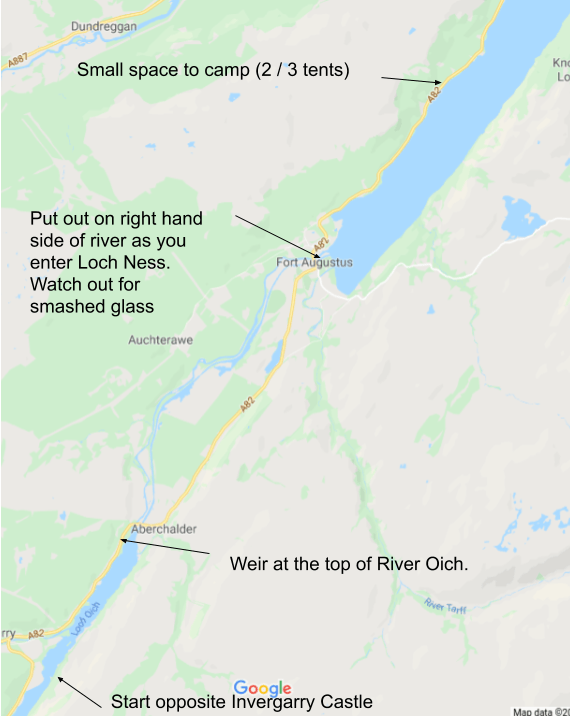
Day 3 was the day I was really looking forward to, and for good reason – the river Oich! In favourable conditions it is possible to run the 8km of the river Oich down to Fort Augustus instead of paddling along the penultimate section of the Caledonian Canal.
The river run had two key advantages. Firstly it meant that we could use to current to carry us along down to the head of Loch Ness instead of having to paddle. Secondly the river has a number of continuous grade 1 and grade 2 rapids that make the journey exciting but not too hazardous.
All of this was of course dependent on the water level in the river. Too low and we would keep bottoming out in the shallower sections of the river, with all the risk of damage our boats. Too high and the grade 2 sections would turn into grade 3+ sections, a level of danger that we were keen to avoid. There were only two of us and we have only limited experience in tougher white water conditions and so would be foolish to attempt the river in spate conditions.
We rose soon after sunrise and took advantage of the calm sunny conditions to have a leisurely breakfast and coffee. It had dropped down to 3 degrees in the night and I hadn’t slept too well – my Static V2 was had an r-value of 1.4 and so was only rated down to 8 degrees, so my back was cold in the night. On the good side, the cold kept most of the midges away in the morning so I was able to enjoy breakfast relatively hassle free.
We packed up slowly and it was 10 o’clock before we were out on the water, heading straight across the narrow lake towards the northern shore. I had spotted an intriguing shipwreck the previous evening and wanted to take a closer look at it. Also the ruin of Invergarry Castle was on the north shore and I wanted to see if I could catch a glimpse of it.
The shipwreck sat tucked inside a small wooded inlet, only a few metres from the shore. It was half submerged and was listing over at about 30 degrees. The starboard deck and half of the cabin were protruding out of the black water, and we could see inside. All the radio and other equipment were still clearly visible inside the boat, even though the boat had clearly been there for years. Either the equipment was worthless or not worth the risk of salvage, or people don’t loot boats up here!
I circled the boat, giving it a wide berth so as to reduce of the risk of hitting any hidden protrusions, and then headed off to join Mark, who was heading off in the direction of the castle. Sadly as we paddled further along the loch it became clear that we weren’t going to be given a clear view of the castle from our boats and we would have to park up and walk up on foot if we wanted a good look. We felt we didn’t have time for this so we reluctantly paddled off along the loch.
The paddle along the remaining kilometer or so was calm and pleasant. Thick woodland lined the banks, shielding us from noise from distant roads. The occasional large boat passed us by in the centre of the loch, far from the shallows that we were paddling through.
Paddling the River Oich
Eventually we arrived at the weir that marked the entrance to the River Oich and we cautiously inspected the state of the river. The main chute ran on the left, hard against a small cliff, and followed the river round the bend to the right under some trees. It looked easy enough to run this first section of rapids – choppy and fun in places but unlikely to cause us any hassles.
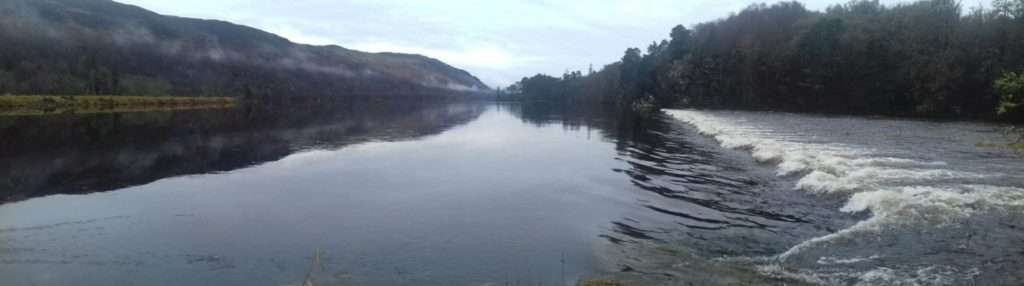
We payed particular attention to depth of water running on the spillover that ran 50 yards to the right of the main chute. Advice on the internet indicated that we should only run the Oich if there was water running over the spillover, as otherwise we would likely bottom out in the shallower areas further down.
I tried to gauge the depth of water passing over the spill and it looked to be about 15cm deep – enough to keep us from hitting the bottom of the river but not too much flow to risk the rapids turning from grade 1/2 to grade 2/3. Normally we would be happy to tackle grade 3 runs but we were fully loaded and there were only two of us – not enough people to execute a rescue should shit hit the fan.
We sat mulling over the situation for a minute in silence before we turned to each other and nodded – let’s go for it.
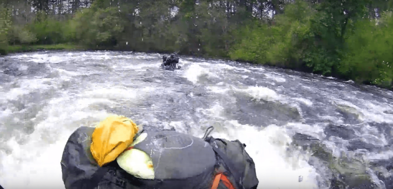
I let Mark go first, partly because he had a spray-deck on and partly because I wanted to capture footage of him running the first set of rapids. He paddled out into the lake, lined himself up, and the accelerated into the chute. As soon as he crossed the weir lined be began bouncing around in the white water, but he had no problems at all.
After Mark cleared the rapids I adjusted my Akaso Brave 4 action camera, a cheap but functional clone of a Go Pro, and set off, following his line of attack.
What followed was an hour of pack rafting pleasure. The grade 1 rapids continued for another 500 yards under the main road bridge, followed by a small suspension footbridge. After that conditions flip-flopped between short but exciting sections that were easy and forgiving, interspersed with calm but fast moving sections.
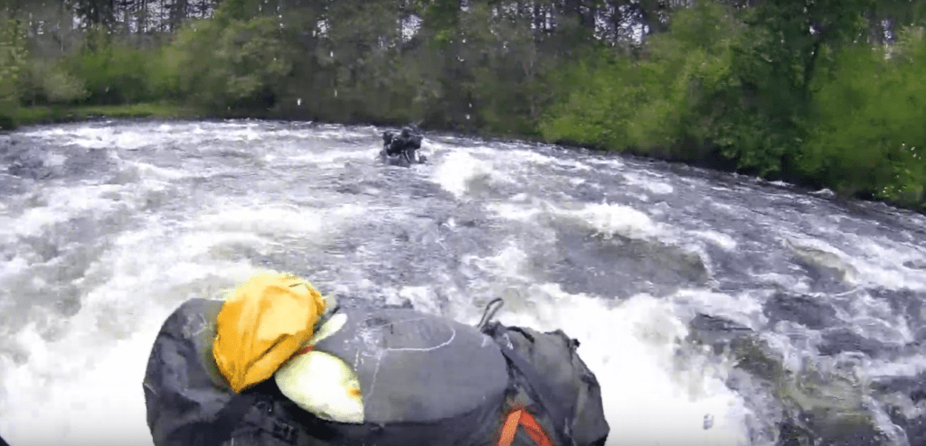
Only the very last set of rapids provided any semblance of challenge, but even then that section was short and followed immediately by a calm section that would have provided an easy opportunity to rescue.
Eventually the river flowed down through Fort Augustus itself, finally casting us out into the south-western end of Loch Ness. We tired and hungry by this point and decided to go mooch around Fort Augustus for an hour or so, grabbing a hearty all-day breakfast and stocking up on supplies.
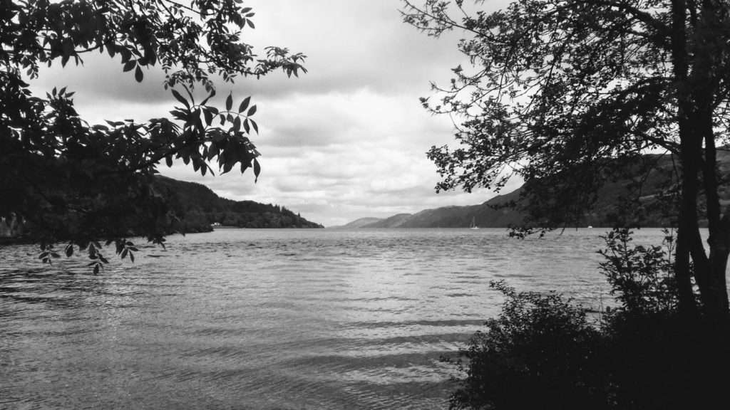
A view of Loch Ness from Fort Augustus
Our next key decision was whether to take the north or south shore along the loch. Given the width of the loch (1km of open water) and our near-terminal adventure on the first day, it was clear that once we picked a side we would have to stick to it.
I favoured traversing the south-east shoreline, on the grounds that it is much flatter and therefore there would be many more wild-camping locations available.
Mark on the other hand wanted to follow the north-western shore, as there was a village with a campsite half-way along the Loch, which meant that we could finally take a proper shower. Mark had also googled the local area and apparently there were a couple of decent pubs where we could have food and beer.
We mulled it over for a few minutes and decided that beer and hot food trumped wild camping – the north shore it was!
By mid afternoon we were ready to rock again and we bimbled back down to the head of the Loch and began the process of unpacking and re-inflating our pack-rafts, which by now we had down to a fine art and were able to be up and running within 10 minutes.
We set out on our trek with a slight tail wind and I quickly raised my mini-sail hopeful of a helping push along the Loch. Sadly it was not to be and a dead calm descended over the loch. It was looking like the sails were going to be pretty much redundant for the entire trip!
We carried on for a couple of hours at a leisurely pace, constantly on the lookout for a suitable camping location. As the OS map had suggested there were pretty much no suitable camping spots available. The land rose up as a steep angle straight from the water, making camping on the shore itself impossible, and the road hugged close to the water, meaning that we couldn’t look further inland for a location.
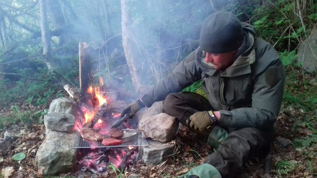
Eventually we found a small beach, no more than 2 metres wide at it’s deepest, and although it was within 20 metres of the road, it was quiet enough for the night. We dragged our boats out and began setting up camp, using rocks and sticks to stake out the fly sheet – a free standing tent would have been very useful.
We built a fire in the remnants of an old fire (this was obviously a well used location both for canoeists and car-based campers) and Mark set about cooking the meat that we had purchase from the butchers in Fort Augustus.
After dinner we finished the last of the rum and beer we had brought along with us (another reason to spend the next night near a pub!) and settled down for an early night!
Route Details