13 Miles – 630m Ascent
I woke up just before dawn and lay with my eyes shut for a while as my brain slowly rebooted and senses slowly began reporting back. My ears soon informed me that the wind had picked up during the night and the buffeting of the tent indicated that the wind must have shifted from the east to a more northerly direction. So much for picking a sheltered location – my wind break had turned into a wind tunnel.
Rather worryingly my body informed me I wasn’t warm, not cold, just not warm. The forecast for Edale last night was a low of 6 Degrees C, so even following the deduct 1 degree with ever 100 metre climbed rule, it should be around 2 degrees at lowest. My brand new sleeping bag had a comfort rating of 2 degrees C, so I should have been comfortably warm. Had I wasted my money? I certainly couldn’t afford to buy another sleeping bag any time in the near future.
It had taken 3 months of painstaking research – endlessly reading blogs, watching YouTube videos, comparing prices – but I had finally found a spring/summer bag that I though precisely met my needs – a bag that had a comfort rating down to 2 degrees, weighed under 700 grams, and most importantly was within my budget of £200. I was going to buy a silk liner anyway to help keep the bag clean and that apparently added a couple of degrees the the comfort zone, but that wasn’t the point – I’m normally a warm sleeper so this bag should have done its job.
I lay sulking for a little while, then finally decided that there was naff all I could do about it for the next couple of weeks and set about the seemingly impossible task of escaping from my goose down prison. I scrabbled around at the top of the bag, trying to feel for the draw-cord toggle that I had used to tighten the neck baffle but failed miserably. Eventually I gave up on the drawstring and managed to locate the zip instead, pulling the zip down slowly with my right hand whilst holding back the draught-excluder to avoid snagging the delicate looking material.
I peered out into the tent, my eyes stinging as they slowly adjusted to the dim morning light.In fact the temperature had dropped significantly below zero and the condensation on the inside of my tent had frozen solid. Every couple of seconds a barrage of wind would whip through the tent and dislodge flakes of ice from the canvas, sending it snowing down onto the inner.
I made a note to myself that I would need to think carefully about where and how I pitched my tent – exposed areas at the top of fells would be non-starter with the weather being so cold and windy. I would need a location that was sheltered even in changeable wind conditions but also I would need to vary the flysheet ground clearance depending on the conditions expected – lower to the ground if windy conditions where expected to reduce the wind chill, higher from the ground if less wind was expected to reduce condensation.
The howling wind and arctic windchill ruled out any notions I had of hot coffee and porridge for breakfast, so instead I rummaged around in the builder’s rubble sack that I had for a food bag, discovered a breakfast bar, and quickly devoured it. I then dived out of the tent to deal with the next most urgent item on today’s agenda, my rather full bladder. I quickly attended to my toilet situation, mostly avoiding decorating my trail running shoes, and then took in my surroundings.
As the highest peak in the Peak district, those who climb reach the summit of Kinder are often rewarded with a fantastic panorama of distant hills. Dozens of high peaks flank Kinder and an a good day you might be lucky to see Pen-y-ghent, 58 miles to the north, or on a crystal clear day, Plynlimon, 102 miles to the south east. Today was not a good day and I could easily throw a stick and be unable to see where it landed. The cloud level had descended in the night and my tent and I was engulfed in a howling, whirling mist. A break in the clouds would arrive every couple of minutes and one of these breaks soon arrived, revealing a beautiful sunrise about to happen.
I crouched back into the tent and grabbed my Nexus 5 to take a picture but even though it had 40% battery when I went to bed it was dead. I rummaged round and found my other phone – a Samsung J6 – also dead. Phones and sub zero temperatures really don’t mix. I chastised myself for not keeping my phone inside my sleeping bag with me to keep it warm (new new bag even had a little pocked just for this purpose!) and in desperation I grabbed my 360 VR camera and ran out – it had a 180 mode which would have to do. I took a few photos of the impending sunrise (often the best sunrise photos are actually taken before dawn) and retreated to my tent to thaw out my freezing cold hands.
Back in the tent I figured I’d need to charge my phones using my power bank and so reached into my electronics stuff sack to retrieve it. After 5 minutes of searching, swearing and more searching, I slowly came to the conclusion that my only USB cable was still plugged into my laptop at school – what a muppet!
I was going to urgently need to find somewhere to buy a USB cable. A phone is an important safety device, invaluable in an emergency situation for both location finding and calling mountain rescue, but more importantly I needed it to take pictures of my trek so I could post it to social media to gain imaginary internet points. I popped my phone in my inside pocket, knowing that as it warmed up the battery would restore itself to somewhere near last night’s charge level, and started packing – it was time to move.
I cautiously dropped the tent, taking care to clip one of the fly sheet guy lines to my rucksack as an insurance policy – if I lost my grip on the tent in these conditions it would be gone for good. Within 5 minutes my bag was packed and I was ready to start the day’s hike.
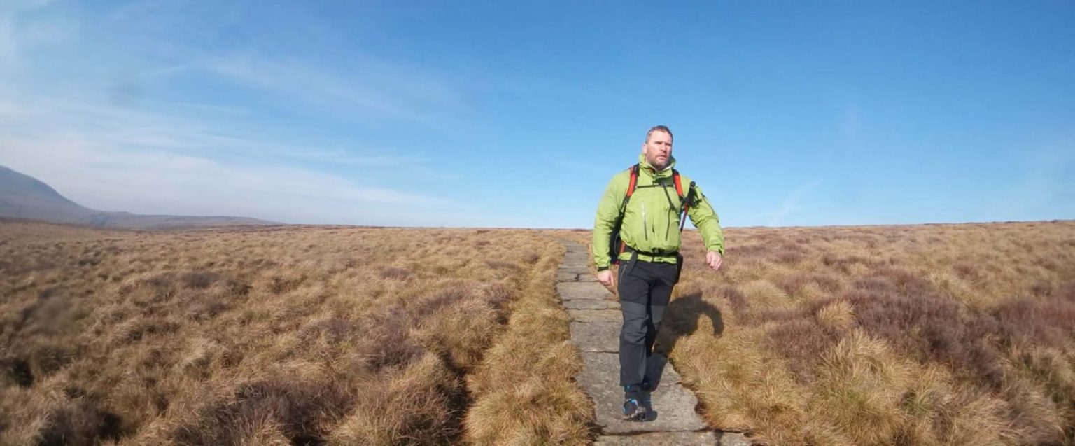
I would soon learn that navigation on the southern section of the PW would be a relatively painless affair – the 1:50,000 maps I had printed out and laminated proving more than sufficient to follow the well marked route. The path was heavily trodden due to Kinder’s proximity to nearby Manchester, and mostly consisted of walking along bare rock channels eroded out of the peat bog, with the occasional detour around the strange grit-stone rock formations that Kinder is famous for.
As I approached the trig point a ghostly figure emerged from the mist, map in hand. It was clear from the size of his pack that he had spent the night on the top like me, and by the look of his face he was enjoying the gale force winds and freezing mist as much as me. I gave a casual nod and we went our separate ways – it was too early for me to talk to strangers, especially given that I had forfeited my morning coffee!
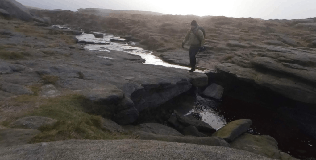
The path continued on roughly due north, cutting a meandering trail between the smooth rock shapes discarded all around. I soon reached the Kinder Downfall, the waterfall after which Kinder Scout’s name is derived (‘Kyndwr Scut’ translates as ‘Water over the edge’). Over millennia the water fall had a cut V shaped valley into the side of the cliff-face and it now careered disarmingly down over gradually steeper rock platforms until it finally rolled over the edge. I although I couldn’t see the bottom of the falls I could hear a faint roar from below and knew it was a fair drop. The wind was gusting dangerously from the east, pushing me towards the top lip and I took extra care to stay well clear of the edge – certain that it would only take one freak gust and things would end rather badly. Sadly, 2 days after the end of my trip, a young woman slipped and fell to her death off the edge of the waterfall whilst on an Easter Monday walk with her family – a heavy price to pay for a mistake easily avoided.
I followed the path as it wound it’s way down off Kinder and headed towards the famous Snake Pass* – a winding, high altitude route that connects Manchester and Sheffield, the two major cities that sit on opposite sides of the Pennines. I was eager to make progress and hoping that the visibility might improve as I lost altitude, I didn’t fancy spending the next 2 weeks staring out into featureless white. Snake pass is
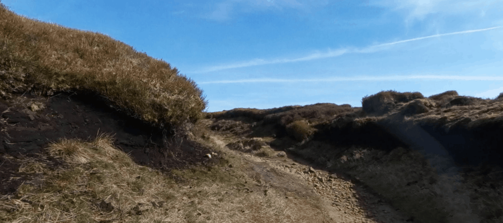
The route by now had moved into open moorland and the path was unmissable – largely rectangular slabs lined the route – and I made good progress. I crossed over Snake Pass and headed into Devil’s Dike, a mile long, 8 foot deep labyrinth of pathways cut out of the peat bog, that was easy to follow due to the stone slabs and bare rock pathways leading the way, but would have been near impossible in the snow conditions that are common in winter months.
By now the clouds had lifted and the sun was making an occasional cameo appearance, so I decided to take advantage of the wind protection offered by the deep gully I was in and cook brunch. There was a constant stream of passersby most of whom merely gave me a quick curious glance or polite greeting, but a few minutes in a couple of men in their 30s stopped for a chat. Their choice of equipment and attire immediately identified them as experienced wild campers – a mixture of expensive rucksacks and cheap army goretex gear. We got chatting about our respective plans and it turned out they were out for a very different kind of trip to mine. They had acquired some mushrooms from guy called ‘Naked Ginger Steve’ and were scouting for a location to set up for the evening and enjoy a few cups of tea. They sat down and shared a few stories about their previous camps and went into great detail (far too much detail), about how Steve earned his nickname. They extended and invitation to me to join them in their journey but I politely declined, pointing out that I was on a mission to walk the Pennine Way and that sadly I couldn’t afford to detour from my itinerary. We bade each other farewell and I watched as they marched off into the distance, once again envious of others’ shorter, more leisurely trips.
The path clambered out of the maze and and rose gently towards the summit of Bleaklow, before veering westward and tracing the top of Torside Clough, a beautiful v-shaped valley, lined on the left with a steep rocky crag. The view from path was spectacular, your gaze followed the valley all the way down to Torside reservoir in the far distance, with sailboats visible on the water. The sun was a semi permanent fixture now and the wind has eased somewhat, so I decided to lay down to rest for a couple of minutes in the soft heather that lined the path.
I was woken up by the sound of stomping boots and opened my eyes. The warm sensation on my face told me that I had been asleep for a good while and I had caught the sun, hopefully not too badly. I picked up my gear and carried on my descent into the Longdendale valley, within 30 minutes I was trotting along the top of the retaining wall of the reservoir dam, elated by the knowledge that my day’s walking was almost complete, having decided to make Crowden Campsite my home for the evening.
The walk alongside Torside was a pleasant one, though I was disappointed to find that Pennine Way didn’t take the pleasant, scenic route alongside the reservoir, but instead ascended the flank of the valley just to drop back down again into Crowden. I was soon to discover that this was pretty standard for the whole route – shunning valleys and low level features wherever possible in favour of higher level routes on the side of fells.
I descended the hill down into Crowden Campsite, a small site part of the Camping and Caravan Club. Upon check-in I was informed that I qualified for a discounted backpacker rate – the company was founded by backpackers and they were keen to support those who traveled the hills on foot. I inquired hopefully if they sold USB cables but unfortunately they didn’t – however the manager said that he would be more than happy to charge my phone for me for me free of charge – brilliant!
I trundled off and set up camp for the evening, happy with my first day’s progress – I had covered a reasonable distance and so far had no injuries at all!
<– Day 0 Edale to Kinder Scout | Day 2 Crowder to Robin Hood’s Bed — >
* It’s a common misconception that snake pass is named due to its winding nature, but this isn’t the case. The original snake pass road followed the course of the nearby roman road, which of course ran straight. The name most likely originates from the Snake Inn which sits at the top of the pass. The road was commissioned by Lord Cavendish as a turnpike to encourage trade (and raise money for his estate) and at the top of the pass an inn was built with his coat of arms above the door. On the top of the coat of arms sat a serpent nowed, a knotted snake, and this is where the name originated. Or so some people think.