
Distance: 30km Ascent : 1100m
I woke up just after 7am with the morning sun beaming down on to the tent. I’d had a much cosier night’s sleep than the previous night, largely due to the more sheltered location and I felt refreshed and eager to cover ground. I boiled up some water for porridge and coffee and then sat contently watching the rest of the campsite slowly groan into life.
After a good 15 minutes and 3 cups of coffee later (I obviously wasn’t that eager to get going!) I set about breaking camp, a far less stressful task than the previous morning due to the calm and sunny conditions. The still and cloudless night had left a heavy dew on the tent and I made sure I gave it a good shake before packing it into my rucksack – every gram counts, I told myself!
I took one last long look around the site, campers pottering about near their caravans, or sat leisurely in their camping chairs reading or relaxing, and set of on my lonely hike up towards black hill.
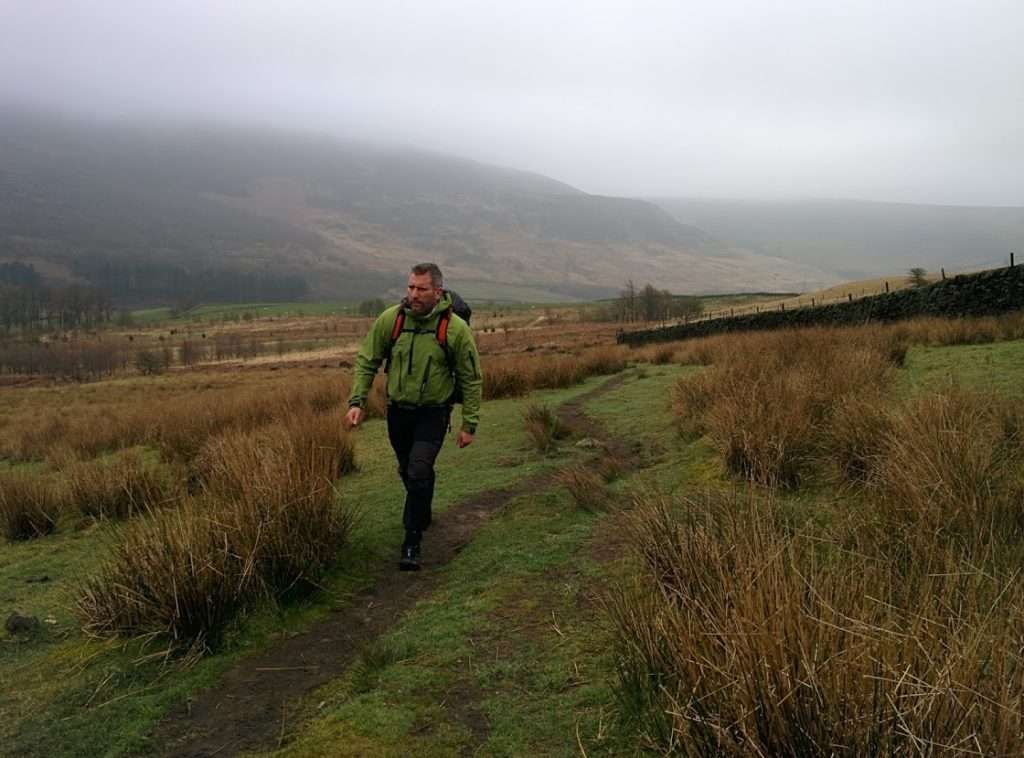
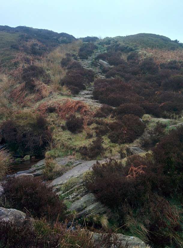
The path traversed the side of small valley for a couple of miles, slowly climbing as it followed a stream towards its source. At the head of the valley the path ran head first into the side of Oaken Clough, a steep shallow gorge, heralding the first steep climb of the day. I wondered about the origins of Oaken Clough, trying to visualise a time long ago when the whole valley was a sprawling deciduous forest – there were no trees at all in the gorge now , save for a couple of juvenile silver birches.
I was more than a touch disappointed by the lack of oak trees. The symbol on the Pennine Way way-markers was an acorn and I had thought naively that this might have been chosen in due to the oak trees on route. In fact it later transpired that the acorn was the symbol for all the national walking routes, not just the Pennine Way. In any case it would be a number of days before I spotted an oak tree on route.
At the top of the gorge the path level out and proceeded trace along the top of a long cliff edge. The haphazard track zigzagged hazardously towards the precipice, often skirting the edge by a matter of inches. By now the wind had gathered strength and a blustery gale was whipping around the cliff and tossing me and my bag around effortlessly.
I decided enough was enough and abandoned the cliff-side path, instead choosing to fight my way along an intermittent sheep trail that ran roughly parallel – I would be adding another 30 minutes on to my journey time but at least I wouldn’t become another statistic.
It was shortly after that I met the first fellow walker of the day. A tall blond guy in fell running attire jogging down across the fell from the west, looking decidedly lost. I gave him my greeting of ‘mornin’, trying to sound more enthusiastic than I was.
It turns out he was very glad to see me. He had flown over on holiday from Norway a week earlier and was going on one last run before heading back. He had failed to factor in the lovely British weather and had got completely lost on the moors. His flight was leaving in 4 hours and he urgently needed to get back to the main road.
I pointed out to him where we were on the map and instructed him on how to get to the nearest main road with mobile phone signal. He thanked me profusely and set off at double speed down the path towards Crowden.
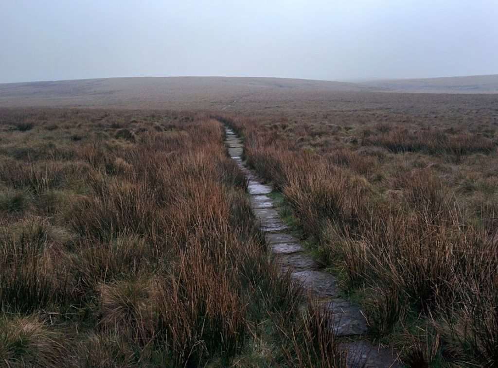
Happy that I had done my good deed for the day I continued up the path towards the summit of Black Moor. By now the path had improved significantly in quality and I was making good time, striding easily on the continuous trail of paving stones.
Much work has been done to improve the pathways along the Pennine way over the years since the trail’s completion in the 1960s, especially on the southern section from Edale to Hebden Bridge. The section heading towards Stoodley Pike particularly notorious for never-ending bogs of shoe stealing mud that would reduce a group’s pace to near standstill.
Today almost all of the Pennine Way’s pathways have been tamed to an extent (except a few small sections near Hadrian’s wall). Hard stone paths, bridges and fords making traversing the moors a far easier and less eventful affair.
If you consider also the other two game changers – GPS navigation and ultralight hiking gear – you can’t help but realise that walking the Pennine Way is significantly less of a challenge than it used to be, even if you are still walking 270 miles.
After reaching the summit and stopping for a quick bite of a crushed and half-melted chocolate bar I began the descent down towards Wessenden Head. Or at least that what the map said. The summit was a blanket of light mist that obscured the view of anything beyond 100 metres or so.
The path yo-yoed up through a small v-shaped valley carved out by a stream and then headed back up to the road ahead. I could see cars passing and a burger van was strategically parked close to the path. I took a brief look at the menu and began to salivate but I resisted temptation. I had already set myself the goal of reaching Marsden before stopping for food and so I marched on past.
My stomach began to rumble and I regretted my decision but I marched on.
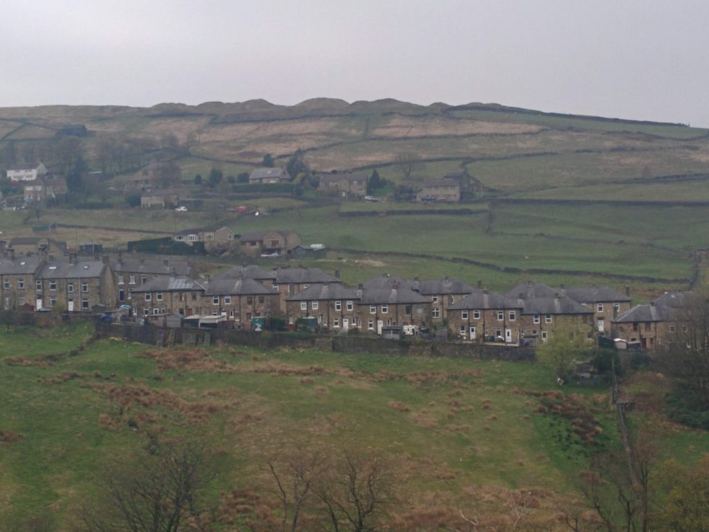
The descent into Marsden was enjoyable and quite charming in that depressingly bleak way the moors have. The path traversed the 4 reservoirs built into the valley above the town, built in stages during the 1800’s to supply water to Huddersfield and the surrounding area the reservoirs.
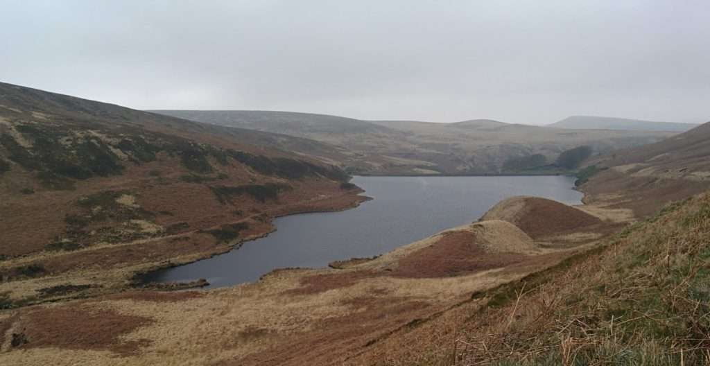
At the northern end of dam on the final reservoir the path turns into a road and drops steeply into the tow itself. Marsden is a pretty typical looking Industrial Revolution era town that grew around the manufacturing of woolen cloth. It’s pretty unremarkable except for the one hidden gem – the Standedge Tunnels.
The tunnels are an impressive feat of engineering – 4 parallel tunnels running 4km underneath the Pennine Hills from Marsden on the east to Diggle on the west. The huge engineering challenges involved almost sunk the project and it took 16 years and leadership of the famous Thomas Telford to drive the project through to completion of the first tunnel in 1811. The first canal tunnel was followed by railway tunnels in the mid 18th century and by the end of the century all 4 tunnels were in use, carry goods and passengers.
Sadly I didn’t know this at the time so I didn’t visit the tunnel’s entrance. I had only ventured into the town because I needed a USB cable to charge my devices and because I wanted a full English Breakfast!
I tried my luck in a charity shop but to no avail – the shop assistant looked at my in a confused ‘are you an alien?’ sort of way, shuffled off and then came back 5 minutes later with a USB powered glitter ball. I excused myself quickly before he could go off hunting again and headed further into town. I found a post office and discovered that they did sell USB cables. I reluctantly bought an overpriced gold one and then headed back up the street to console myself with something I had been dreaming of all morning – my full English breakfast!
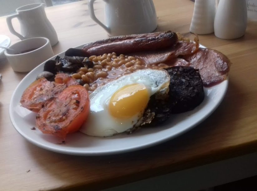
It probably took 15 minutes for the staff to bring me my plate, but it only took me 5 to wolf it down. I was only 2 days into my trip and the dry rations of pasta and noodles were already starting to get boring, so this was an luxury!
Afterwards I sat for another ten minutes, attempting to wash away the fatty residue from my mouth with slow sips of my pot of tea. The counter behind me was stacked full with an assortment of massive wedges of home cakes and desserts and I was tempted to indulge, but I knew I had better leave. I’d been studying the next section of map while drinking my tea and it was becoming apparent that I still had another 10km or so to go if I was going to reach the motorway bridge, which I had set as my target for the day.
Reluctantly I dragged myself back to feet, paid for my food, and headed back out into the fresh spring air. I needed to head west to join back up with the Pennine Way, so I hike back up a steep road, lined on one side with a row of terraced cottages, and followed along the the Standedge Trail, which joined up with the PW at the top of the hill.
It was about this time that I had two realizations. Firstly I observed that this route was quite a bit busier then the route I had followed all morning. Secondly I realized that I had made a big mistake in not taking advantage of the toilet facilities back in town.
The shift back to normal food had awoken my bowels and now they were demanding immediate attention. This would have been fine anywhere on route I’d been walking in the morning – I had my trusty orange spade with me so I could just nip out 30m away from the path and disappear into the mist and mounds of moorland. Here the were no mounds and no mist…
I carried on walking for a few hundred meters, hoping in vain that the rumblings would subside, scanning around to see if any dog walkers were around. Eventually I realized that things were just that desperate and I was going to have to risk it. I ran off the path as far as I could, tried digging with my spade and failed miserably and instead resorted to ripping up a huge tuft of grass.
As soon as I squatted down an unstoppable torrent came rushing out. I felt total relief for a moment until I caught a glimpse of heads bobbing in the distance. Cue frantic wiping with toilet paper, rearrangement of clothing and replacement of grass tuft, hiding my disgrace. It was clear that I was going to have to pay better attention to the toilet situation otherwise I was going to get arrested for public indecency!
I set off again, dignity in tatters, and soon rejoined the PW at the crest of the way. The climb up from Marsden had been steep and somewhat traumatic, so I was glad to be back on the trail.
For the next hour I trekked north-west along the ridgeline from White Hill. The hill dropped off steeply to my left and the cloud has lifted enough to a afford a pleasant view of the towns below, sprawling along the valley floor and off towards Manchester. The townsfolk were fortunately to have such a beautiful rambling area nearby.
It was just past 5 when I the 57m footbridge over the motorway bridge came in view. I had seen that bridge many times on car journeys and it was unmistakable, and thought I had often seen walkers crossing it I never imagined that I would one day be joining their ranks as a Pennine Way hiker.
Most motorway footbridges bridges were ugly utilitarian monstrosities, but this bridge was special. The bridge followed the curved of the hillside down and then slow arched back upwards to meet the hill on the other side.
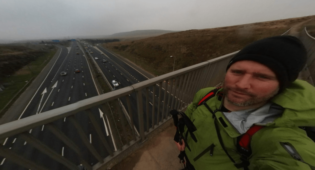
I stopped in the middle for a few moments, following the cars hurtling along underneath and up onto the top of the Pennine hills. This stretch of road is particularly hazardous in the winter – as recently as 2018 3500 vehicles were trapped overnight due to heavy snow, with 200 people stranded in their cars.
I picked up my pack and bounded along the last few metres and off to the other side – it was getting late and it was time for me to think about pitching up my tent for the evening.
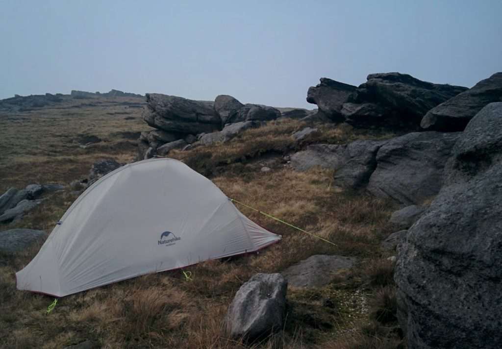
I had spotted a promising looking location on the map – what looked like a small boulder field 1 mile north at Robin Hood’s Bed.
When I finally arrived I was not disappointed – the location was almost perfect (except for a lack of onsite water source). The large boulders offered excellent protection from the wind (which was now picking up considerably) and the site was just far enough away from the path to offer protection from view. I didn’t anticipate any trouble but there was a burnt out car back near the motorway bridge so I decided not to take any chances.
I quickly pitched up my tent as the sky darkened, made some pasta for dinner, and settled down for the night, exhausted.
<– Day 1 Kinder Scout to Crowden |
Route Details
- Distance : 30km
- Ascent : 1174m
- Wild Camping Location : Robin Hood’s Bed – SD 971 162