Our journey began in the ancient city of Winchester, on the western fringes of the South Downs. We had decided to take the afternoon train up the night before and spend the night a night in the Travelodge in the the center of town, and it was definitely the right choice – this small and welcoming city had everything we needed to rest and prepare for the journey ahead.
After checking into our room and dumping our gear we headed out for a spot of sightseeing before dinner. I had done some googling on the train on journey over and it turned out that Winchester had plenty to offer to the casual visitor – one of my few regrets of the trip was not spending an extra night at the beginning of the trip getting to know the place better.
Winchester has a rich and varied history that stretches back long before the Roman occupation of Britain and we had little trouble entertaining ourselves before dinner time, strolling through medieval city streets from one historical attraction to the next.
First off we visited Winchester Cathedral, which was just behind our hotel and so we headed straight over to the entrance to see if we could go in. Lizzy was keen to take a look at the Sir Antony Gormley sculpture in the crypt below. Unfortunately it was already 6pm and the cathedral had closed for the evening already.
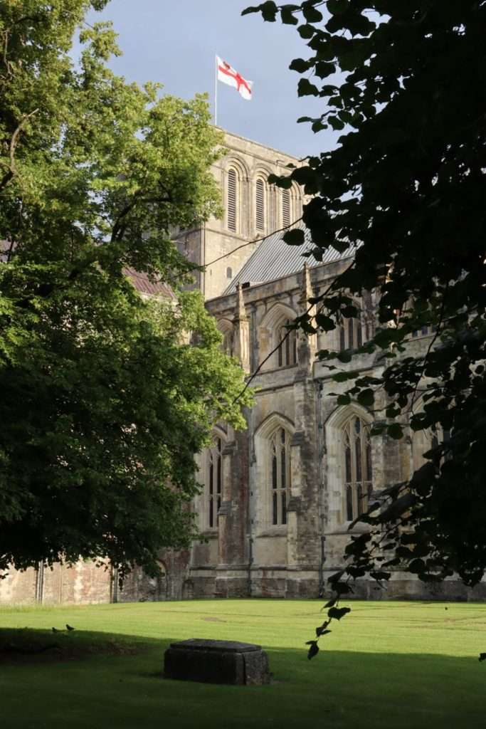
We took a few photos of the outside and decided instead to head round the back towards to take a look at the Old Bishops Palace. Here we had no luck either – an outdoor performance was being held in the palace grounds and so it was ticket only!
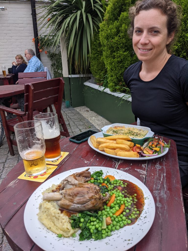
Having been defeated twice in a matter of minutes we opted to go find somewhere for dinner. It was the height of July and most of the restaurants were full but we managed to find a pub that could serve up a roast dinner!
After dinner and a couple more pints we headed back to our hotel to finish packing and grab some sleep, ready for our 7am start the next day!
The alarm went off at some ungodly hour and we dragged ourselves out of bed. The hotel didn’t offer breakfast so instead we packed our gear and trundled over the nearby Greggs to grab a bacon butty and a coffee. Foraging complete we turned our minds to the next task of actually getting to the start of SDW.
They say that the first step in any journey is the hardest and in the case of the South Downs Way this way this was definitely true – mainly because we couldn’t actually find the start!
Whilst the entire route was marked on the electronic OS map we were using, a number of other trails converged and crossed in Winchester and so it wasn’t entirely clear exactly where the trail started.
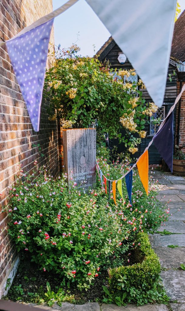
After an mini tour of the city centre we eventually stumbled upon a rather modest little plaque behind a railing, half hidden by flowers and bunting. To save future walkers the same hassle we had I have added a pin to Google Maps so people know where to go!
They say that the first step in any journey is the hardest. In this case it was definitely true, as we couldn’t actually find the start…
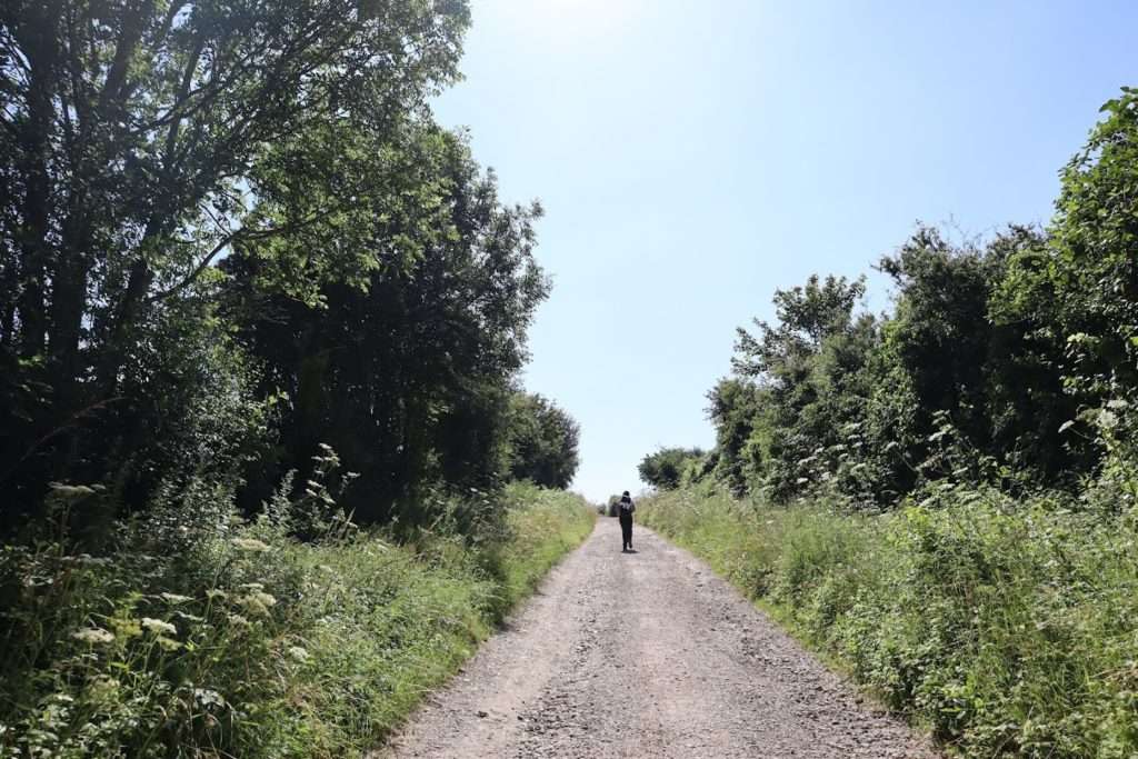
We took a couple of snaps of the start plaque and then we were off, taking our first steps of many on this 100 mile long trail. The trail followed a footpath downstream by the riverside for a few hundred yards and then it cut east across the river and uphill through a maze of small streets. We were ‘geographically embarrassed’ a couple more times on the route out of town, largely due to the midsummer growth on the bushes hiding the signage, but thankfully a number of locals guided us back to correct route and soon we were in sight of the footbridge that marks that true start of the trail.
Out into the countryside
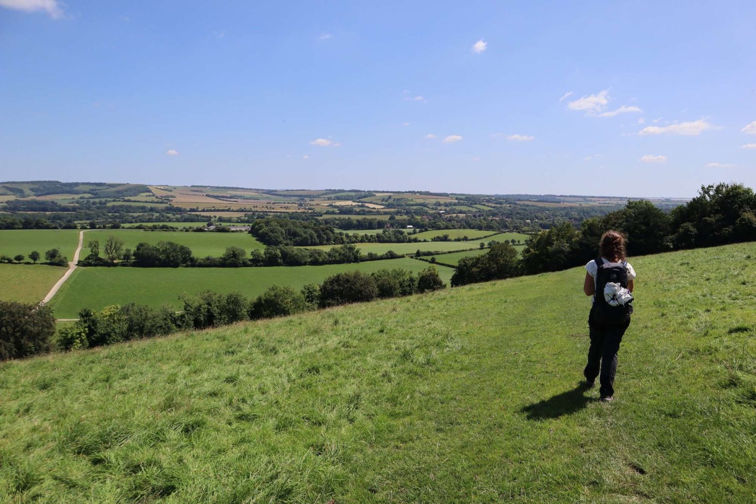
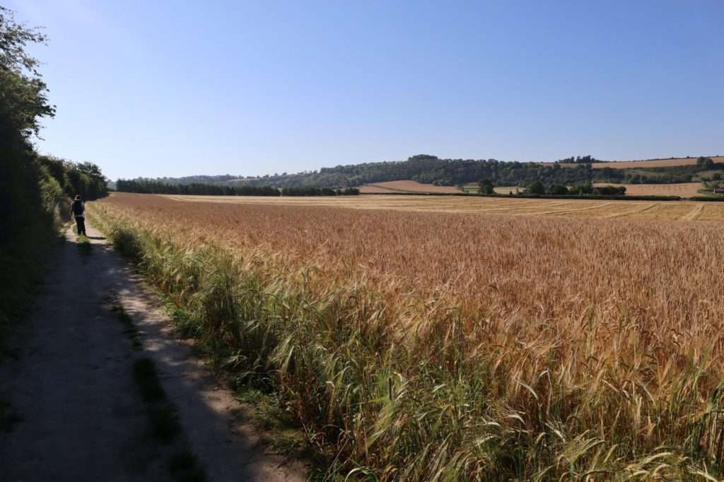
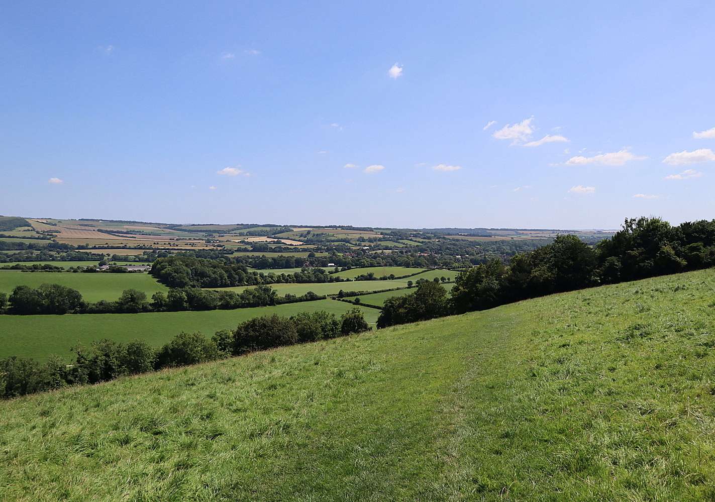
Only when we crossed the footbridge over the the M3 and swapped city streets for farmers fields did it finally feel like we were proper hikers on a through hiking mission. The drone of the motorway traffic began to fade into the background and the trail opened up into the sprawling blond wheat fields that are characteristic of most of the first half of the trail.
It was barely past 9am and already the temperature was creeping up past 20 degrees in the cloudless skies. I was a glad for the shade that the high hedgerows offered but it knew it wouldn’t last long.
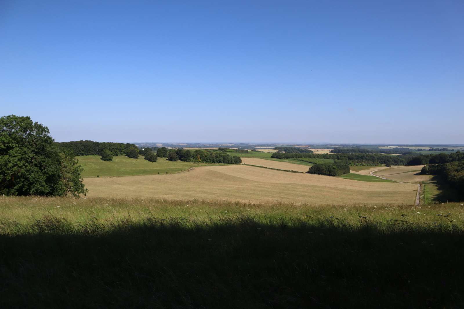
After an hour or so of walking the trail opened out and climbed up to the top of the first proper hill. At the top of the hill stood the remains of an iron age ‘tumuli’ burial mound , one of the ancient artefacts that litter the tops of the downs.
The Downs have been a main thoroughfare for thousands of years and for good reason. The high slopes offer great visibility all around and the dry chalk is excellent for walking on all year round – far superior to the muddy clay based soil of the Weald below.
We stopped for a quick bite to eat and photo opportunity before carrying on along the route, eager to make progress and start ticking off the miles.
A natural amphitheatre
Soon after we reached Matterley Bowl, a bowl concave depression in the side of a hill that forms a huge natural amphitheater. The area was used extensively for troop barracks and training throughout World War Two and was the location chosen by Eisenhower to give his now famous order of the day speech to troops on the eve of the D Day landings .
More recently the the site has been home to a number of festivals and is the annual home of the Boom Town Fair, an immersive theatrical experience.
By now the temperature had already reached the mid twenties and I was worried that we were going to struggle to reach our intended destination for the first day – The Sustainability Center campsite at Leydene Park. At 21 miles along from Winchester it was a good distance to walk even in ideal conditions and the heat made tough going.
Lunch Stop
We stopped for a pint and a sandwich at The Millburys Pub, taking the opportunity to fill up our water bottles at the same time. After some discussion we decided to change our plans and shorten our day.
After a bit of googling we located and booked a pitch at Meonvale Farm Campsite. At 14 miles it was easy enough to reach but still a respectable distance for the first day of our trip. Now that we had a fixed destination, all we had to do we get there.
We finished up lunch and headed back out onto the trail. Lizzy was full of energy and keen to get to the campsite early so that we have plenty of time to relax. She was also somewhat relieved that we had an actual campsite booked and that we wouldn’t just end up wild camping in a bush somewhere.
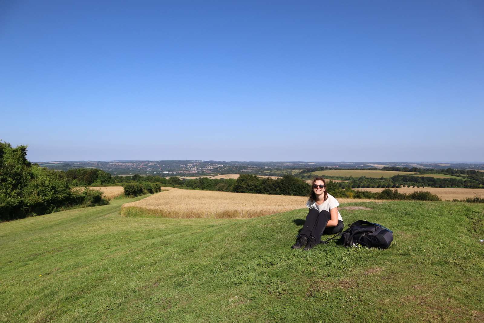
After another hour or so Lizzy striding ahead and me plodding along behind, we reached the top of Beacon Hill, the highest point on our trip so far. The view was a real taste of things to come and we stopped to take a few photos before beginning our descent into the Exton valley.
As walked down the hill we could see the tops of the houses of the village and so we knew we weren’t too far away. 20 minutes later and we were sat having another pint, this time at the Shoe Inn, a delightful little pub by the side of the stream that runs through the village.

If you get chance to visit it is well worth it, especially on a sunny day – though be aware that is gets somewhat busy and is shut from 3pm to 6pm.
After nursing our pints for half an hour we decided we’d best get going and headed along to the campsite, a basic site in a farmer’s field. The site had the advantage of being situated right next to the side of the trail, so we wouldn’t have to waste time and energy getting back on trail the next morning.
Once at the campsite I set about erecting the tent, my ultralight Aricxi 20D trekking pole tent that I had brought specifically for this trip. This took significantly longer than expected, partly because trekking pole tents can be a bit fiddly and partly because I hadn’t practiced as much as I should have!

After setting up the tent I got my titanium stove, one many favourite(and cheapest!) pieces of camping gear, and boiled up the two wet ration dinner that we have brought with us on the trip. These weighed significantly more that the dry rations and so I was determined to eat them first.
Ever since my crippling hike of the 95 mile long West Highland Way in Scotland, where my pack weighed over 23kgs at the start, I had been slowly replacing my gear with lighter weight alternatives. I had now gotten it down to around 10kgs and I wasn’t about to miss an opportunity to trim a few hundred more grams!
With dinner over we decided to head back to the pub for another pint and a second dinner, returning at sunset to our lovely, if now slightly busier campsite. We were both knackered and so were soon snoring away in our cozy little tent!
Leg Information
- Distance Travelled: 22km
- Height Climbed: 420m
- Accommodation: Camping at Meonvale Campsite booked online.
- Alternative camping available at Holden Farm